As may be clear from my recent postings on rumours in Wuhan, the language of Wuhan, a timeline and bibliography about Wuhan, and a post on Wuhan on the eve of revolution, I have been spending some time to get to know this fascinating tri-city at the center of China, composed of the once separate cities of Hankou, Hanyang, and Wuchang. I thought I would use this post to share a few of the historical maps available online that I have found most interesting:
武漢城鎮合圖 – Wuhan 1864 – Library of Congress
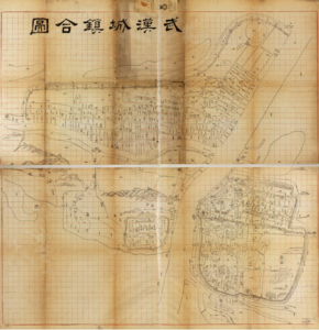 This map, available for download from the LOC is dated 1864. The British concession in the city, which was only opened a few years earlier can been seen as still a mostly empty area in the northern section of Hankou, next to the circle representing the racetrack. The timing of the map could not have been earlier than 1864 given that it depicts city walls around the edges of Hankou, which were only built in that year, mostly along the canal along Hankou’s northern edge (護城河 on map but also known as 玉带河).
  This map resembles closely a redrawn map that William Rowe uses in his fantastic two volume history of Hankou from 1796-1889. The map is wonderful to browse and in many places, the proportions seem about right when it comes to streets, even as the map preserves a landscape profile view of the hills in Guishan (龟山) area north of the Hanyang walled city, and the hills that split Wuchang north and south, bounded on the Western side by the Yellow Crane Tower (黄鹤楼). However, beyond the city streets, other areas seem a bit off in terms of proportions, such as the land between the Han river and the Guishan hills, which appears to me to be much larger an area of land than it should be.
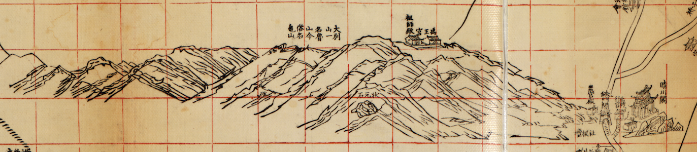
Above you can see some of the depiction of Wuhan’s hills in Hanyang and Wuchang. Besides the relatively empty streets and racecourse of Hankou’s British concession, there is very little in terms of evidence of the foreign presence. Zooming in closely will show the French and British consulates, and the Customs office. This will soon change as we move just a few years ahead in time for the next two maps of Hankou and Wuchang.
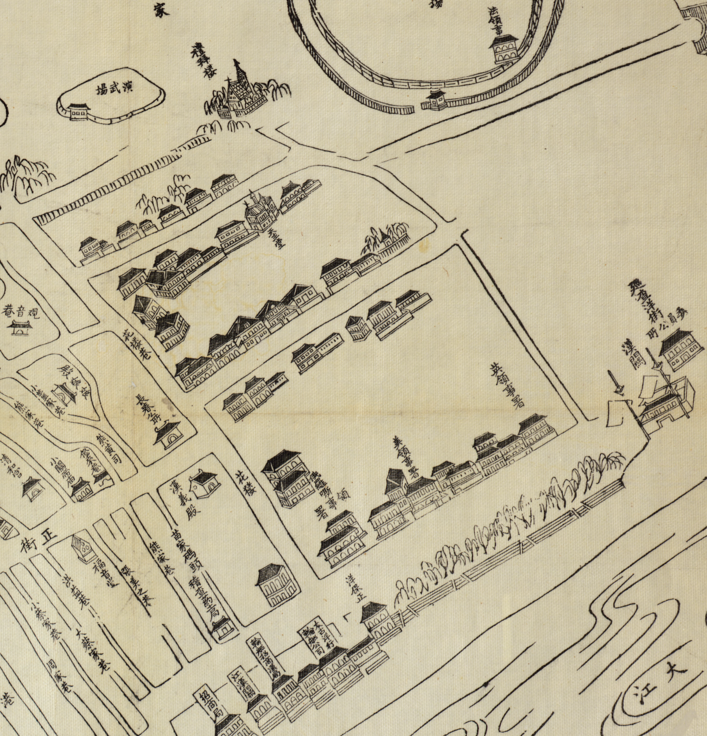
湖北漢口鎮街道圖 – Hankou 1877 – Library of Congress
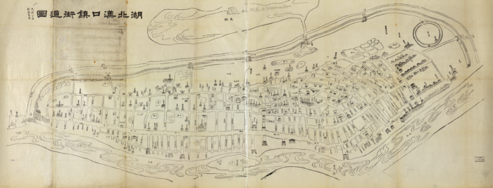
This map, focusing on Hankou, stretches the city horizontally for a better rectangular fit. Far more buildings and gates are marked on the map in general, but most prominent is the explosion of buildings marked in the new British concession in the eastern side of the map. We now see churches, the American and Russian consulates, among other buildings. In both this map and the previous one, the French consulate is located on or inside the racetrack, rather than in what would become the French concession from 1896.
湖北省城內外街道總圖 – Wuchang 1885 – Library of Congress
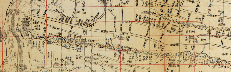
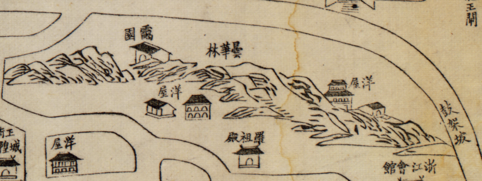
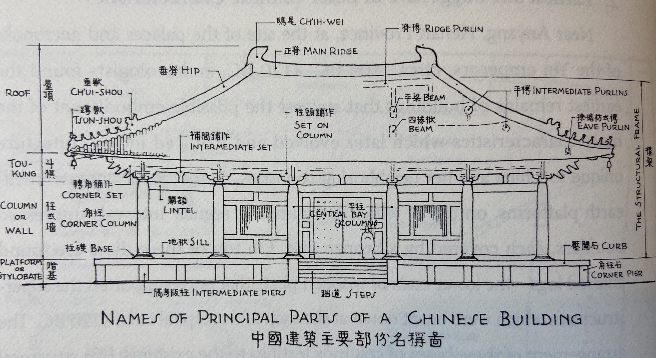
 This map of Wuchang, as capital of Hubei province, is dated 1885. By this point, the Hankow Medical Mission Hospital has been founded, the Wuchang Wesleyan mission has opened in southern Wuchang, the London Missionary hospital has been established, the Hankow Golf Club has been founded, the Russians have established a brick-tea factory, and there is a large enough concentration of foreign missionaries that Wuhan becomes one of the central publishing centers for Christian tracts in China with its Central China Tract Society. Now, here and there, scattered among the other buildings you can detect the presence of the foreigner in Wuchang as well, not merely in the foreign concessions across the river in Hankou. Note the buildings with the 洋屋 (Foreign houses) labels. Throughout these older maps, they tend to be distinguished by their many windows, while other buildings are usually are marked by their entrances, columns, and the stylobate platforms at the base.
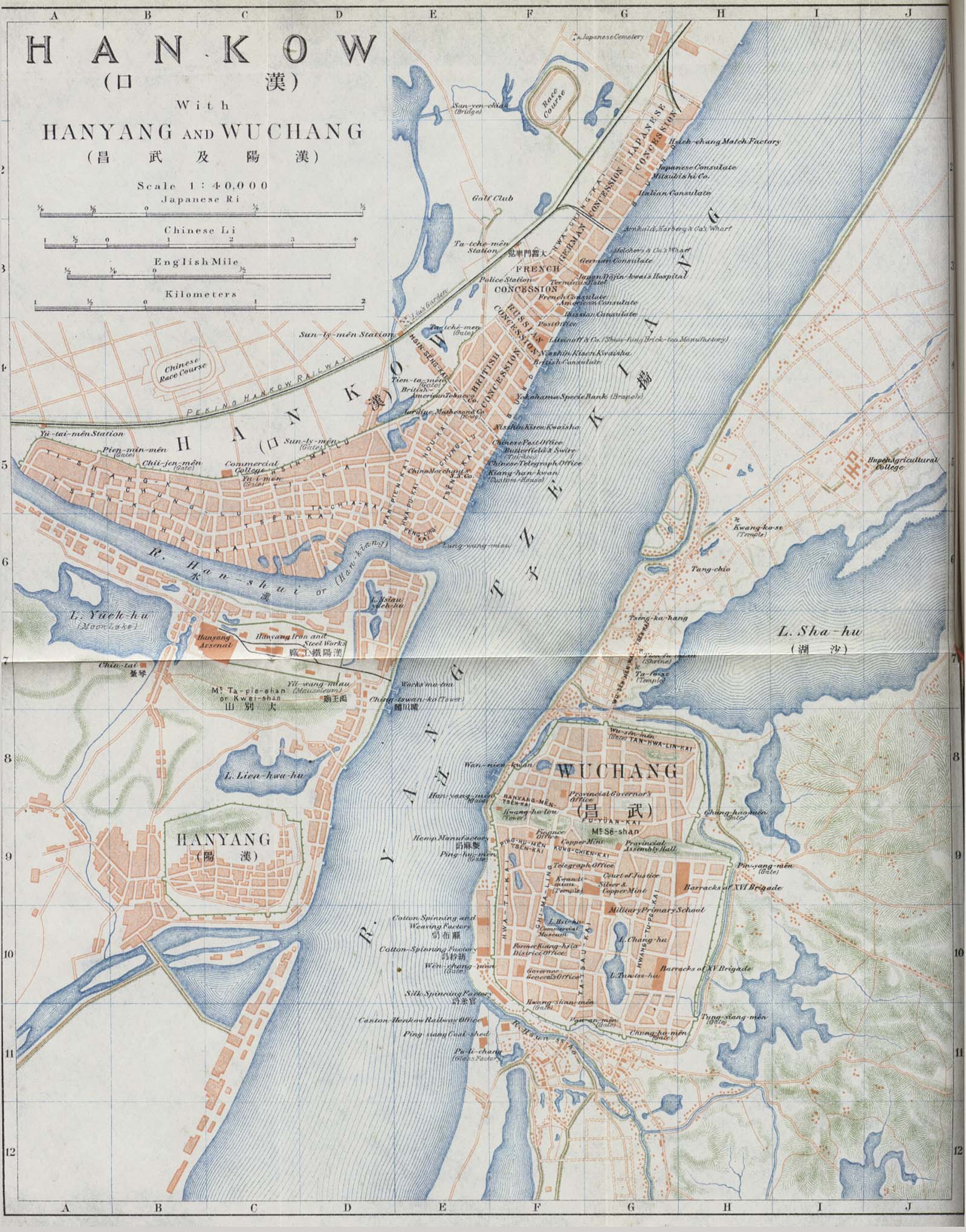
Hankow. Series G.S.G.S. no. 3831 – 1927 – Princeton
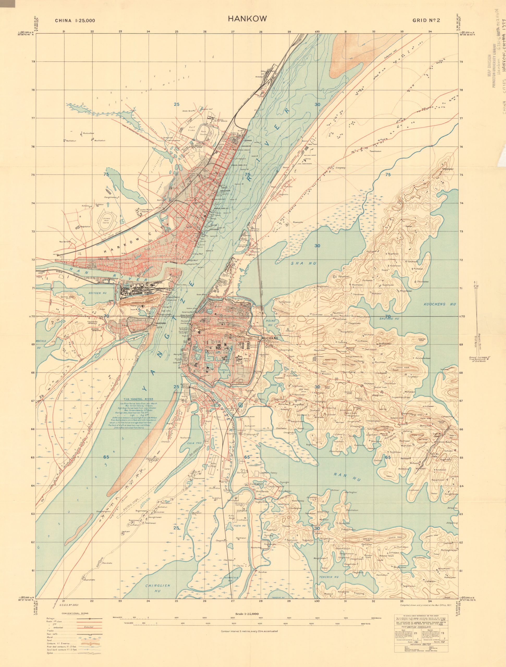
This map is one of the British War Office maps that can be found for many Chinese cities. A full 160MB tiff version is available for download from Princeton. This one looks like it is on the basis of surveying, with its regular grid, and latitudes and longitudes in the corner points. Other Chinese cities in this series I’ve seen, such as the map for Yantai from a few years earlier, are reproductions of late Chinese imperial or early republican period maps.
I have been using this map as a starting point for the creation of a series of map layers for a Wuhan historical GIS project, and while most of the streets in Hankou, and a number of other locations in Hanyang georectify nicely when the corner points are added, things get very strange further out towards the known points at the edges.
More challenging is the course of the river itself. Rivers, of course, change course, most infamously for the Yellow River, which, depending on the time, can result in very different maps for places such as Shandong. In this case, the SW corner point for this map is located at 30.464633, 114.250225 (the result of converting 30° 27’52.68″ N, 114° 15’00.81 E to decimal format) is today not right on the eastern edge of the river, but in the center of a village on the river’s edge. This could simply be land reclamation on the eastern side, but the curve of the river is such that some of the buildings on the western shore of this 1927 map appear in the river itself when compared to maps today. Instead of land reclamation, if that is accurate, it would appear parts of the land on the western side were gobbled up. More on that in a later posting on the Wuhan GIS materials.
On this map we now see the railway lines (Beijing to Hankou, and the incomplete Guanghzou to Hankou on the eastern side, eventually connected by bridge in 1957), all of the concessions (the “special areas” are the former Russian and German concessions returned to Chinese control, and the British concession will formally become one of these special areas the very same year this map is dated). Notice that, except for some of the more important buildings in Wuchang, the British cartographers have very little interest in locations relevant for Chinese residents in the city. Not too the “Mat huts” and “Area thickly populated by Chinese living mostly in huts” just to the south of the Hankow Golf Club. This map will be reprinted and modified several times in the years to come, sometimes with minor changes or additions in the labels and can be found with later dates in various archives (See this one here for example).

最新漢口市街詳圖 – Hankou 1939 – National Library of Australia
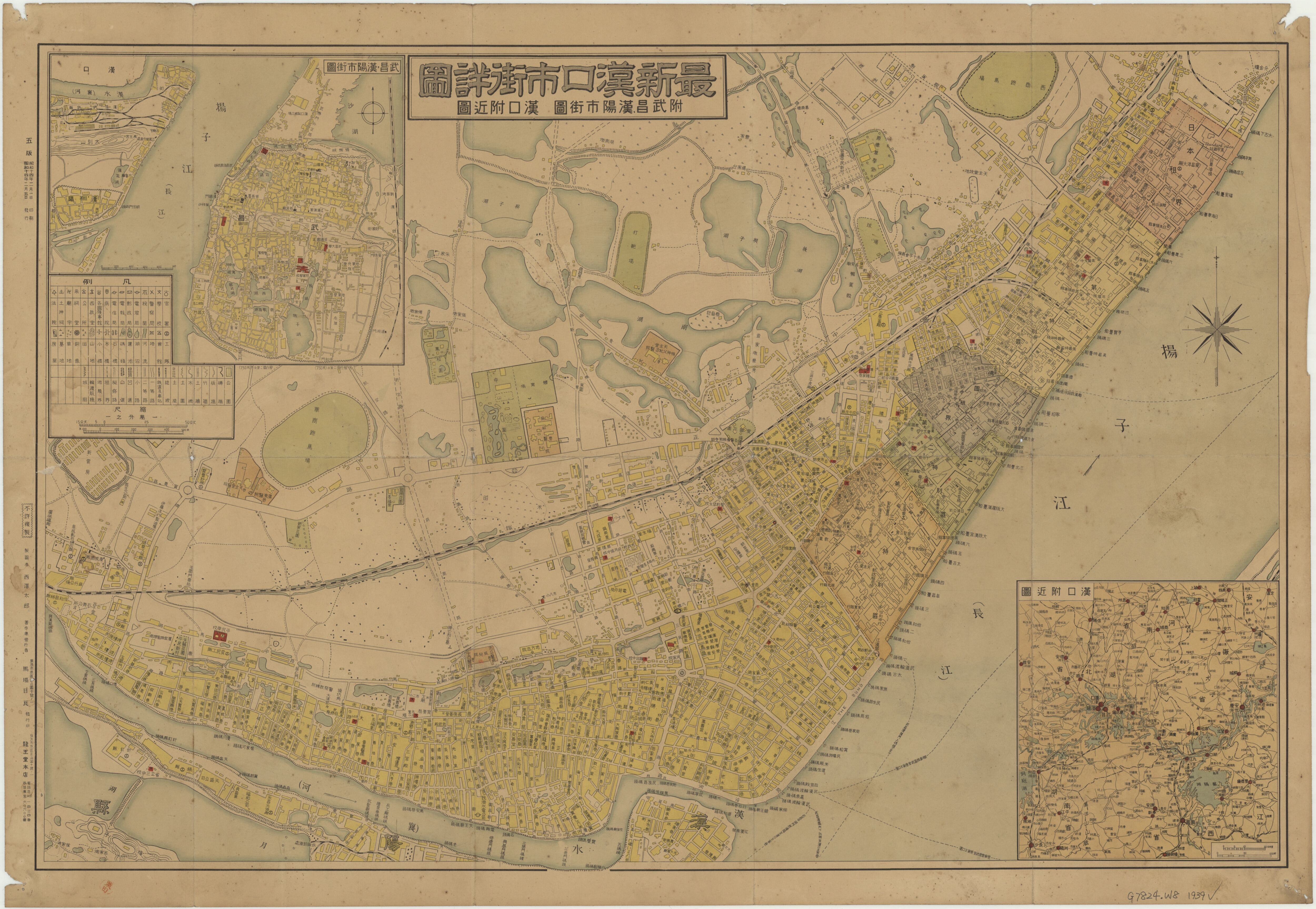
This fascinating map of Hankou, with an inset of Hanyang and Wuchang in the top left, was printed only some four months after Wuhan was occupied by Japanese military forces in late October, 1938. Ever since the fall of Nanjing in December, 1937, with the massacre there that followed, Wuhan had become China’s capital and the center of cultural and political activity as intellectuals from all over China as well as from elsewhere in the world streamed into the city and shifted the publication of many wartime works there. For this period, consider taking a look at Stephen R. MacKinnon’s Wuhan, 1938: War, Refugees, and the Making of Modern China.
By the time the city was occupied by the Japanese, there was only one foreign concession left, the French, but the Japanese concession, which had been dismantled after full scale war began in 1937, was quickly restored. Despite this, however, the map clearly shows the boundaries of the old concession boundaries even if they were now called special districts.
Compared to the 1927 British map, there is much to be learned about the Chinese parts of the city. It helps that everything is shown in Kanji/Hanzi characters rather than Wade-Giles or other romanized versions for names and even most of the smaller alleyways are named and shown, as well as many more of the schools, some of the 會館 guild halls, Chinese character names for various foreign institutions, and the location of temples and factories, though these are often not named.
 Those who are interested in the process of the occupation itself, may want to see this 1947 war crimes trial exhibit (Court Exh. No. 2570: Map showing various sectors or divisions of the city of Hankow, and showing the various routes of entry of the several units and their disposition) available with more details through the digital collections of the Japan’s National Diet Library, which includes a translation of some statements regarding the entry into the city by Japanese forces. Many more references to Wuhan and the Japanese occupation can be found in the digital archive JACAR.
Wu-han 4-74 Central Intelligence Agency – 1974 – Library of Congress
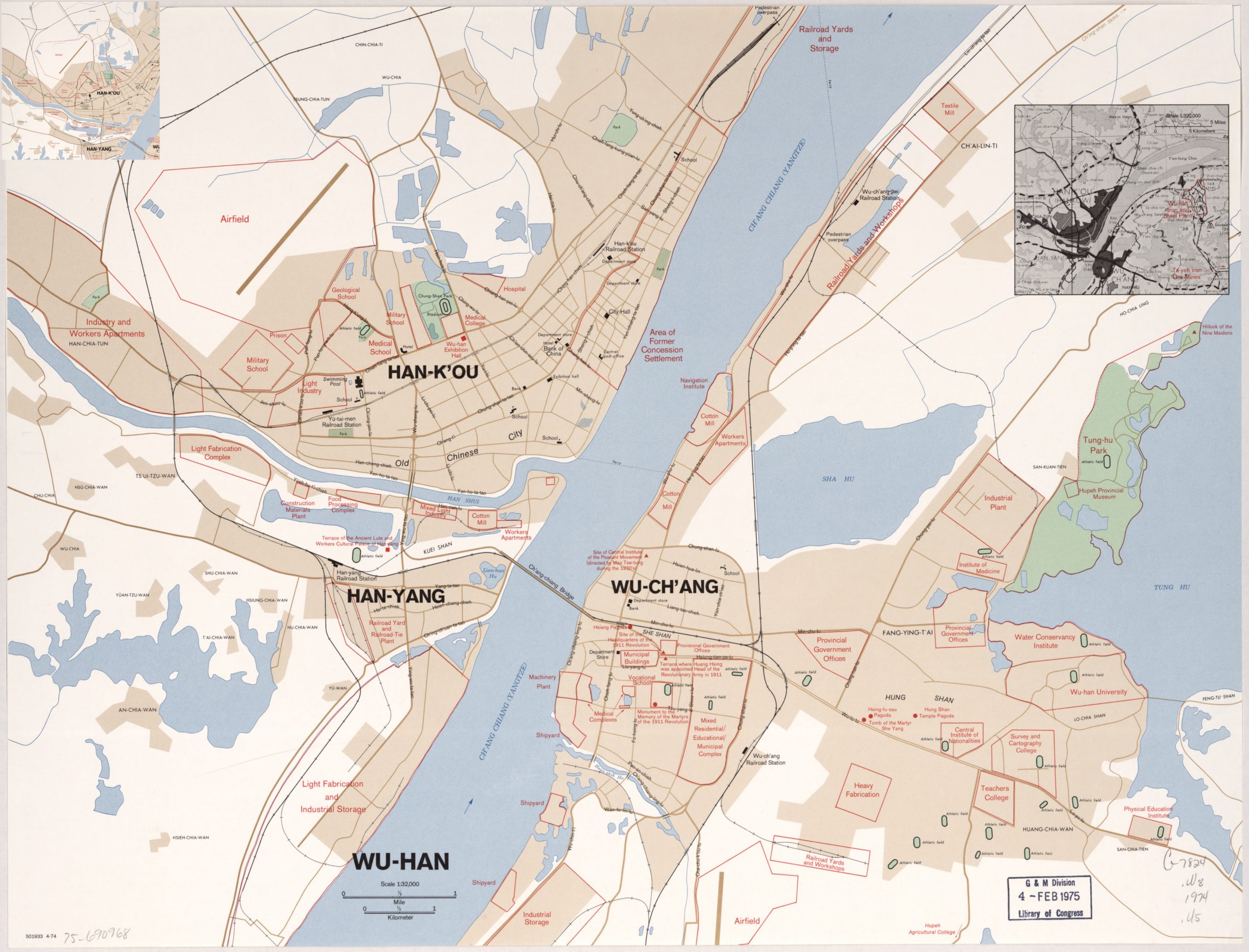
This 1970s CIA map includes a few locations of cultural and historical importance, such as a few pagodas and temples, but what strikes me the most about this map is the way its labels look suited for identification from the sky. In fact, the way in which many of the highlighted areas generically label government building districts, shipyards, and light and heavy industry it looks like the kind of map which would be useful for planning a bombing raid, rather than a stroll around town. Even the small scale inset map seems to primarily serve to offer a few more bomber targets in the form of steel plants and iron ore mines.
Wuhan GIS
I’ve been working on georectifying and digitizing features from the British 1927 map and the Japanese 1939 map above, as well as building a layer with the locations of extant historical sites from Wuhan today (I’m already very grateful to Wuhan historian Chris Courtney for help so far). There is also some mapping work done by the Virtual Hankou project which includes a much more detailed map of the French concession in 1940. I’ll share more about this project in a future post but in the meantime, would welcome any pointers (by email or @kmlawson on twitter) to other 20th century maps of Wuhan that show a good amount of material, particularly in Chinese. Some of those that I haven’t mentioned include this 1946 map, which lacks good enough resolution, and this map from 1915, which similarly lacks detail.